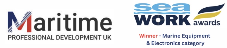
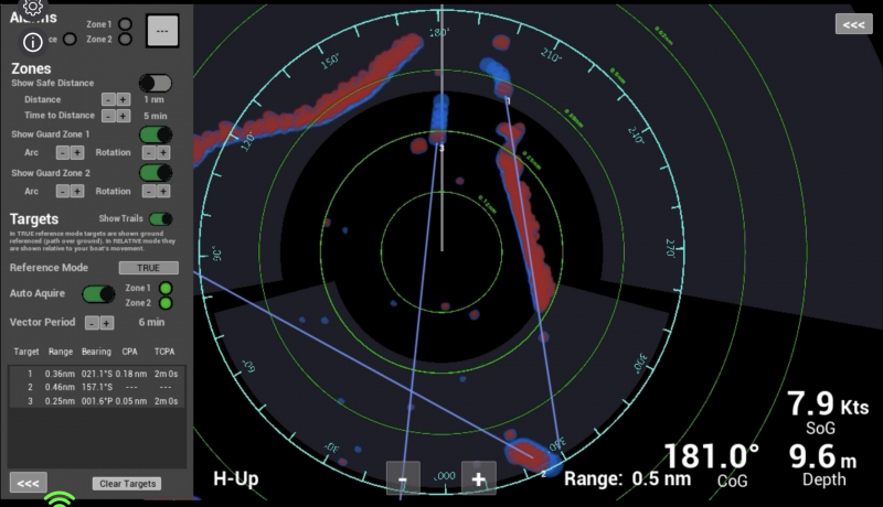
This version of our simulator marries S57 ENCs for the area in which your harbour or estuary is based with an overlay from Google Maps of the shoreline providing a highly realistic interpretation of your area of operation. Onto this we overlay a radar return from shore areas, buoys, marinas etc. The radar returns around the area can be optimised as part of the set-up process to ensure that the returns accurately reflect the real returns experienced when transiting the area of operation.
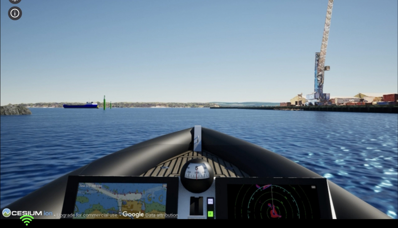
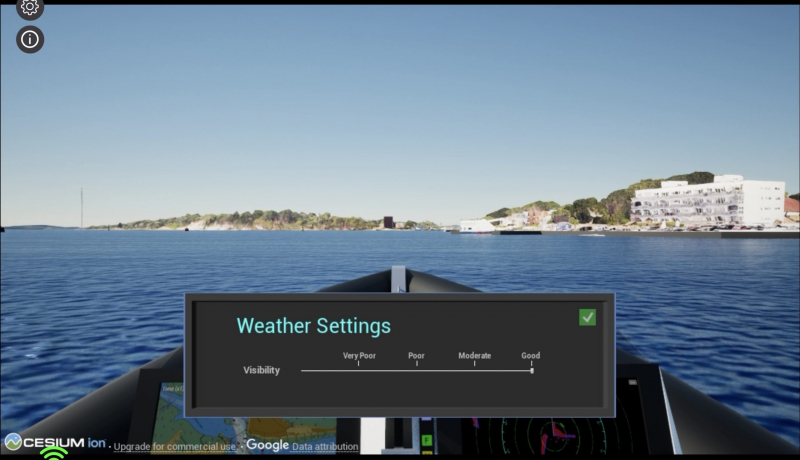
The level of visibility can be varied between ‘Very poor’ and ‘Good’.
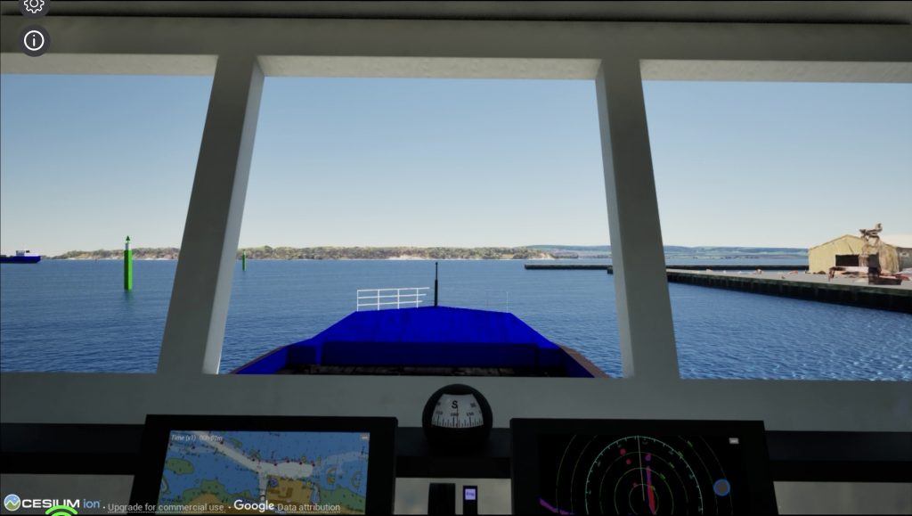
The simulator allows navigation into the harbour/estuary either on a vessel such as a pilot vessel or on the bridge of a large vessel as the pilot. The size of the vessel being piloted, the bridge position and the rate of turn can all be programmed into the exercise allowing a highly realistic and valuable exercise to be run.
The radar/MFD has all the functionality as outlined in the page for the RYA Radar Course version of the simulator.
The benefits of choosing to make this product available to your team or those operating in your area are:
- Rapid and regular training without any need to travel as the simulator is run at any location in the cloud.
- Highly realistic training that can be rolled out to users beyond your usual core group of skippers/coxswains, pilots and crew increasing the competence and safety of those who may need to operate in either good or poor visibility in your area.
- Simulator can be configured to assess exercises conducted, to output performance metrics and (as an option) ‘pass/fail’ those undertaking exercises giving those responsible for the safety of the area substantive proof that they have assessed to a pre-agreed standard those they endorse to operate in the area.
- Harbour Master (by way of example) can manage access to simulator for all their approved users, allocate access periods and review users‘ performance.
- Substantial cost savings versus hiring simulator time on maritime college bridge training systems
The S57 ENCs can be updated as required to ensure the accuracy of the exercise and if relevant information from LTNMs fed into the simulator’s database to reflect any changes in the area of operation that have not populated through to the ENCs
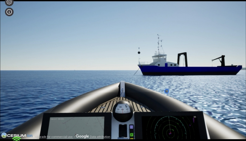
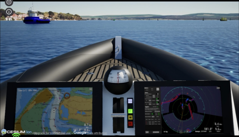
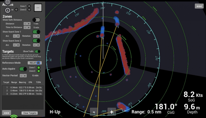
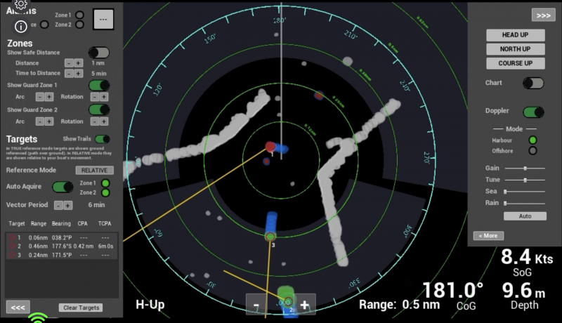
Images are from RIB version of the simulator – users can choose between an open vessel (eg RIB) or cabin type vessel as required to conduct exercises with.
Contact us about this simulator product to arrange a demonstration HERE